Newberry freeze center: pipe-freeze risk, alerts and forecast
How cold it will get, for how long, and what that means for pipes in Newberry County homes: the NWS hourly forecast turned into a pipe-freeze risk level, every active freeze, winter, flood and storm alert, and a year of alert history.
Last updated . This page checks the National Weather Service every 15 minutes and refreshes itself. For life-safety decisions, follow official NWS warnings, a NOAA Weather Radio and local emergency officials.
Pipe-freeze risk for Newberry, the week ahead
Pipe-freeze risk, the week ahead: Low
- Coldest hour: 50°F, Fri, Oct 30 at 8:00 AM ET
- Hours at or below 32°F: 0; at or below 28°F: 0; at or below 20°F: 0
No freezing temperatures in the hourly forecast. A good week to find your main shutoff, buy faucet covers and check pipe insulation before the first hard freeze.
Computed from the National Weather Service hourly forecast for Newberry, updated Fri, Oct 30 at 7:42 AM ET. Low spots, river bottoms and rural yards often run colder than the forecast point. Thresholds: 32°F freezing; 28°F the NWS hard-freeze level; 20°F the freeze-alert threshold for homes in southern states from University of Illinois research.
How the risk levels work · Night-before checklist · Thaw a frozen pipe
Active freeze, winter, flood and storm alerts
Counties: Newberry, Lexington, Saluda, Laurens, Union, Fairfield, Richland. Newberry, Lexington, Saluda, Fairfield and Richland are covered by NWS Columbia; Laurens and Union by NWS Greenville-Spartanburg.
No active flood, freeze, winter or tropical alerts from the National Weather Service for the counties this site covers.
Checked Fri, Oct 30 at 7:42 AM ET. Source: National Weather Service (api.weather.gov).
No freeze warning does not mean no pipe risk. The National Weather Service aims its frost and freeze alerts at plants and the growing season, so a midwinter night in the low 20s may come with no freeze warning. The risk meter above uses the hourly temperature forecast, not alerts. Why.
Nightly lows for Newberry
No freezing lows in the 7-day NWS forecast for Newberry. Coldest night: Sunday Night, low 51°F. Freeze prep checklist.
Forecast for Newberry
Today: Sunny, with a high near 79. Northeast wind around 3 mph.
NWS forecast for Newberry, updated Fri, Oct 30 at 7:42 AM ET.
How cold has it been? Newberry's hard freezes
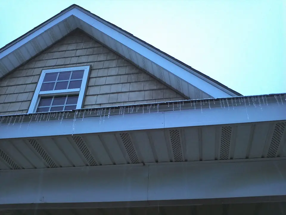
NOAA's cooperative weather station in Newberry, with records back to 1893, averaged about 55 nights a winter at or below 32°F, 33 at or below 28°F and 6 at or below 20°F over the winters from 2008-09 through 2025-26. The coldest recent mornings were 8°F on January 7, 2014 and January 2, 2018, and 10°F on December 24, 2022. The all-time low is −8°F on February 14, 1899. Full freeze history and winter-by-winter table.
Alert history by county, last 12 months
| County | Hurricane and tropical | Flood | Freeze and cold | Winter storm and ice |
|---|---|---|---|---|
| Newberry | 0 | 12 | 13 | 4 |
| Lexington | 0 | 30 | 14 | 4 |
| Saluda | 0 | 13 | 13 | 4 |
| Laurens | 0 | 4 | 7 | 5 |
| Union | 0 | 3 | 7 | 5 |
| Fairfield | 0 | 18 | 13 | 4 |
| Richland | 0 | 41 | 14 | 4 |
Number of National Weather Service watches, warnings and advisories issued in the last 365 days, through Oct 30, 2026, from the Iowa Environmental Mesonet archive of NWS products. One alert can cover several counties.
Latest freeze, winter, flood and tropical alerts (up to 40)
| Issued | Alert | Counties | Product |
|---|---|---|---|
| Oct 12, 2026 | Flood Warning | Richland | NWS text (CAE) |
| Oct 12, 2026 | Flood Warning | Lexington, Richland | NWS text (CAE) |
| Oct 11, 2026 | Flood Advisory | Lexington, Richland | NWS text (CAE) |
| Oct 10, 2026 | Flash Flood Warning | Lexington, Saluda | NWS text (CAE) |
| Oct 10, 2026 | Flood Watch | Laurens | NWS text (GSP) |
| Sep 22, 2026 | Flood Advisory | Union | NWS text (GSP) |
| Sep 22, 2026 | Flood Advisory | Richland | NWS text (CAE) |
| Sep 22, 2026 | Flood Advisory | Fairfield | NWS text (CAE) |
| Sep 20, 2026 | Flood Advisory | Saluda | NWS text (CAE) |
| Sep 20, 2026 | Flood Advisory | Newberry | NWS text (CAE) |
| Sep 11, 2026 | Flood Advisory | Saluda | NWS text (CAE) |
| Sep 11, 2026 | Flood Advisory | Fairfield, Richland | NWS text (CAE) |
| Sep 5, 2026 | Flood Advisory | Lexington, Richland | NWS text (CAE) |
| Aug 27, 2026 | Flood Advisory | Richland | NWS text (CAE) |
| Aug 21, 2026 | Flood Advisory | Fairfield | NWS text (CAE) |
| Aug 21, 2026 | Flood Advisory | Fairfield, Newberry | NWS text (CAE) |
| Aug 13, 2026 | Flood Advisory | Richland | NWS text (CAE) |
| Aug 12, 2026 | Flash Flood Warning | Union | NWS text (GSP) |
| Aug 12, 2026 | Flood Advisory | Union | NWS text (GSP) |
| Aug 10, 2026 | Flash Flood Warning | Richland | NWS text (CAE) |
| Aug 10, 2026 | Flood Advisory | Richland | NWS text (CAE) |
| Aug 6, 2026 | Flood Advisory | Fairfield, Newberry | NWS text (CAE) |
| Aug 6, 2026 | Flash Flood Warning | Lexington, Newberry, Saluda | NWS text (CAE) |
| Aug 6, 2026 | Flood Advisory | Lexington, Newberry, Saluda | NWS text (CAE) |
| Aug 6, 2026 | Flash Flood Warning | Lexington, Richland | NWS text (CAE) |
| Aug 6, 2026 | Flash Flood Warning | Lexington, Richland | NWS text (CAE) |
| Aug 6, 2026 | Flood Advisory | Lexington, Richland | NWS text (CAE) |
| Aug 6, 2026 | Flood Advisory | Lexington, Richland | NWS text (CAE) |
| Aug 5, 2026 | Flood Advisory | Lexington, Newberry, Saluda | NWS text (CAE) |
| Aug 5, 2026 | Flood Advisory | Lexington | NWS text (CAE) |
| Aug 4, 2026 | Flood Advisory | Fairfield | NWS text (CAE) |
| Aug 4, 2026 | Flood Advisory | Richland | NWS text (CAE) |
| Aug 4, 2026 | Flood Advisory | Richland | NWS text (CAE) |
| Aug 2, 2026 | Flood Advisory | Lexington, Richland | NWS text (CAE) |
| Aug 1, 2026 | Flood Advisory | Lexington, Richland | NWS text (CAE) |
| Aug 1, 2026 | Flood Advisory | Richland | NWS text (CAE) |
| Aug 1, 2026 | Flood Advisory | Lexington | NWS text (CAE) |
| Aug 1, 2026 | Flash Flood Warning | Richland | NWS text (CAE) |
| Aug 1, 2026 | Flash Flood Warning | Lexington, Richland | NWS text (CAE) |
| Jul 24, 2026 | Flood Watch | Lexington, Richland | NWS text (CAE) |
What each alert means for your plumbing
| Alert | What it means | What to do about pipes and water |
|---|---|---|
| Freeze watch / freeze warning (with hard-freeze wording) | Freezing temperatures possible (watch) or expected (warning). Since October 2024, hard freezes are announced inside the freeze warning. | Disconnect hoses, cover spigots and backflow devices, insulate exposed pipes, drip faucets, open cabinets on outside walls, close crawl space vents. Freeze prep |
| Cold weather advisory / extreme cold warning | Dangerously cold temperatures or wind chills; these replaced the wind chill products in 2024. | Keep heat on day and night; check crawl spaces, manufactured home skirting and well houses. Crawl spaces |
| Winter storm / ice storm warning | Snow or ice heavy enough to bring down trees and power lines. | Store water (especially on a well), know your shutoff, plan for no heat. Power outages |
| Flood watch / flood warning / flash flood warning | Flooding possible (watch), happening or about to happen (warning). | Move valuables up, never drive through flood water. Homeowners policies do not cover flood. Flood vs water damage |
| Tropical storm / hurricane watch or warning | Inland tropical storms can bring flooding rain, wind and outages to the Midlands. | Store drinking water, photograph the house, plan for a well pump without power. |
After the freeze
- As it warms, check the crawl space, water heater, pump house and under sinks for leaks.
- If a pipe burst, close the main shutoff. Shutoffs
- Photograph damage before cleanup. Checklist
- Follow any boil-water notice. Boil-water notices
- Call a licensed plumber or well contractor. Directory
Official sources
- NWS Columbia, SC (forecast office), 2909 Aviation Way, West Columbia, SC 29170, (803) 822-8135; NWS Greenville-Spartanburg covers Laurens and Union counties
- Hazardous weather outlook (NWS Columbia) · NWS National Water Prediction Service (river gauges)
- Newberry County Emergency Management, 540 Wilson Road, (803) 321-2135 · South Carolina Emergency Management Division (SCEMD)
- Power outages: Newberry Electric Cooperative · City of Newberry Utilities (803-321-1018; after hours 803-276-0311)
- South Carolina Department of Insurance (803-737-6160)
Pipe-freeze risk: computed by this site from the NWS hourly forecast (api.weather.gov) for Newberry; thresholds of 32°F, 28°F (NWS hard freeze) and 20°F (University of Illinois / IBHS alert threshold for southern homes). Active alerts and forecast: National Weather Service. Alert history: NWS watch, warning and advisory products for the counties and forecast zones this site covers, from the Iowa Environmental Mesonet archive at Iowa State University, since January 2025. Freeze history: NOAA ACIS. Your own yard can be colder than the forecast point.